
Road infrastructure has its own readiness scale for automated driving
Suppliers call it autonomous vehicle infrastructure. Road authorities write tenders for C-ITS readiness, connected vehicle readiness or infrastructure support for automated driving. The vocabulary matters, because a procurement gets searched and scored in the authority’s language. There’s a second problem. The most familiar scale in the field, the SAE levels of driving automation, describes the wrong object.
Why don’t SAE levels describe a road?
SAE J3016 classifies driving automation systems and the role they perform in the driving task. It does not classify road-infrastructure readiness.
The EU-funded INFRAMIX project built a scale for infrastructure, and its authors state that the two are independent and not linked to SAE levels: in their example, an SAE Level 3 vehicle doesn’t need infrastructure support level B to operate. The project’s later classification scheme adds that a vehicle with automated functions may get no infrastructure support at all and still stay within its operational design domain and its SAE level.
Treating the two as one scale is a recurring problem, and it can lead to specifications asking for a road to be “Level 4 ready”, which has no defined meaning.
What do the five ISAD classes measure?
The Infrastructure Support for Automated Driving scheme is widely called the ISAD levels. The 2018 paper that introduced it spoke of ISA levels; INFRAMIX’s 2019 classification work recommends ISAD class instead, to avoid confusion with SAE levels, and both terms remain in use. The scheme runs from class E, the lowest, to class A.
Class E, conventional infrastructure. No digital information is available, so vehicles recognise road geometry and signs on their own.
Class D, static digital information. A digital map provides static rules such as speed limits, while traffic lights, road works and variable message signs are still left to the vehicle.
Class C, dynamic digital information. Dynamic information, including variable speed limits, VMS content, traffic-light status, incidents and weather warnings, is also available in digital form.
Class B, cooperative perception. Infrastructure sensors perceive microscopic traffic situations and share them with vehicles in real time. Probe data from equipped vehicles can augment this but, as the original paper notes, cannot replace it, since it depends on which vehicles are equipped.
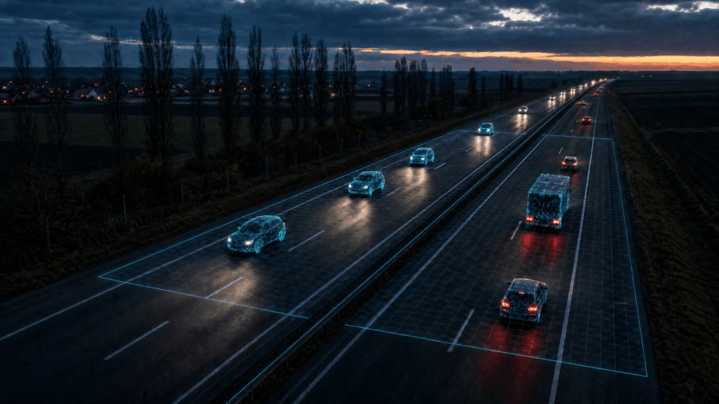
Class A, cooperative driving. The infrastructure tracks vehicle trajectories and guides automated vehicles, individually or in groups, with speed, gap and lane-change advice to optimise traffic flow. The same paper ties classes to connectivity: sporadic updates at D, every few seconds at C, milliseconds at B and A.
Where does C-ITS fit into ISAD?
ISAD classifies the support a road section can provide to automated vehicles. Cooperative intelligent transport systems, or C-ITS, provide standardised services and message exchange that can deliver part of that support. INFRAMIX’s 2019 scheme maps the two explicitly: for class C it points to DATEX II, widespread in Europe for dynamic information; class B associates real-time support data with C-ITS Day 1 messages; class A, where the infrastructure guides vehicles, with Day 2 services and beyond. ETSI’s Collective Perception Message, TS 103 324 (2023), now gives perception data a standard carrier.
The European Commission’s 2016 C-ITS strategy grouped the first services into Day 1 and Day 1.5, and NordicWay 3 piloted both groups in real-world deployments between 2019 and 2023, in close collaboration with C-Roads. According to the Commission’s 2019 analysis, Day 1 services are primarily based on the exchange of CAM, DENM, IVIM, SPATEM and MAPEM messages. CAM and DENM are specified in ETSI EN 302 637-2 and EN 302 637-3; SPATEM, MAPEM and IVIM in TS 103 301.
That gives C-ITS readiness a concrete test: can the operator’s systems generate and distribute the information required for the relevant C-ITS services, using harmonised profiles that compatible vehicles can interpret consistently? European interoperability runs through the C-Roads Platform, where 21 European states and their road operators coordinate harmonised C-ITS deployment and operation based on common specifications. Those specifications are not EU law: the Commission’s 2019 C-ITS delegated regulation was rejected by the Council in July 2019. The revised ITS Directive, (EU) 2023/2661, instead requires speed limits, traffic circulation plans and roadworks data in digital format, exactly what class C needs.
Which class should a road authority aim for?
ISAD classifies individual road sections, and the original INFRAMIX paper illustrates it with a network that mixes classes: a corridor with class B or A support, sections at C, a secondary network partly at D, and rural areas with no support. ASFINAG’s preliminary classification of the Austrian motorway network, published in INFRAMIX’s 2019 scheme, shows the same pattern in practice. Most of the network sits at class D, and none at class E, since map data covers every section. A 23 km stretch of the A2 used as the ALP.Lab test area, with dense sensing that tracks individual vehicles, is class B. Different sections can justify different classes, and the task is to decide what support each corridor needs.
Moving a section up a class takes more than digitising what already exists. INFRAMIX describes class C as requiring a considerable upgrade of a typical traffic management centre, together with HD maps and automated data processing; on ASFINAG’s network, the difference between D and C often relates to the availability of real-time weather data. Classes B and A add microscopic perception and cooperative guidance along the corridor. Finland’s motorway work, which tested an ISAD-based framework on 160 km per direction of the E12 between Helsinki and Tampere, found short-range communications and ODD/ISAD information absent, and concluded in a 2024 Traficom report that upgrade costs and socio-economic benefits still need more analysis, and recommended starting with “no-regret” measures that help manual and automated driving alike.
A useful procurement question is which additional capability justifies the next class on a given corridor.
What should a readiness assessment produce?
A useful readiness assessment produces three things. A classification places each section on the ISAD scale as it stands today. A gap list states what each section needs to move up a class: a digital map, dynamic data interfaces and the traffic management capability behind them, cooperative perception sensors or guidance capability. An upgrade sequence orders those steps against the corridors where connected and automated vehicles are expected first.
A single readiness score for a whole network averages away the information an authority needs. Nor is a class fixed: INFRAMIX expects downgrades or upgrades during roadworks, incidents or bad weather, so state when each class holds. Connected infrastructure readiness belongs to a road section, and it gets planned that way.
Frequently asked questions
What are ISAD levels?
ISAD stands for Infrastructure Support for Automated Driving. An INFRAMIX paper by ASFINAG and Abertis introduced five levels, E to A, in 2018 as ISA levels; the project’s 2019 classification work recommends calling them classes to avoid confusion with SAE levels. Each class describes how much digital and physical support a road section gives automated vehicles.
Are ISAD levels the same as SAE levels?
No. SAE levels classify a vehicle’s automation capability, while ISAD classes classify the road’s support for automated driving. The INFRAMIX authors state the two are independent: a vehicle at a given SAE level does not require a matching infrastructure class, and each is assessed separately.
What are C-ITS Day 1 services?
Day 1 services are the first deployment group in the European Commission’s 2016 C-ITS strategy, covering hazardous-location notifications and signage applications. The Commission’s 2019 analysis says they are primarily based on the exchange of CAM, DENM, IVIM, SPATEM and MAPEM messages.
Does every road need to reach ISAD level A?
No. ISAD classifies individual road sections, and INFRAMIX’s examples combine different classes across one network. The right target depends on the support each corridor needs, and the effort of moving a section up a class depends on its existing infrastructure, data sources and traffic management capability.
Lillyneir designs and integrates connected infrastructure for automated and cooperative driving, from roadside sensing and communication through to the data interfaces that make infrastructure information available to vehicles. If you are assessing a network’s readiness, we are glad to talk it through.